Weather Alert in Florida
Special Weather Statement issued March 3 at 5:41PM EST by NWS Jacksonville FL
AREAS AFFECTED: Coastal Nassau; Coastal Duval; Coastal Flagler; Northeast Coastal St. Johns; Southeast Coastal St. Johns; Northern Inland St. Johns; Southern Inland St. Johns; Coastal Glynn; Coastal Camden
DESCRIPTION: Sea fog is developing as low stratus clouds settle to the ground from the coast and intracoastal waters towards I-95 with locations at Craig airfield, Fernandina Beach, and Mayport reporting visibility around 1 mile. The sea fog will occasionally reduce visibilities to under 1 mile through sunset and the early evening hours. Dense sea fog will likely expand inland during the early to mid evening hours, when Dense Fog Advisories will likely be re-issued for all of coastal southeast Georgia and coastal northeast Florida. Motorists should remain alert for sudden changes in visibility this afternoon, particularly along coastal roads such as A-1A in northeast Florida and U.S. Highway 17 in southeast Georgia. If you encounter sea fog while driving in these coastal locations this afternoon, slow down and leave extra distance ahead of you in case a sudden stop is needed.
INSTRUCTION: N/A
Want more detail? Get the Complete 7 Day and Night Detailed Forecast!
Current U.S. National Radar--Current
The Current National Weather Radar is shown below with a UTC Time (subtract 5 hours from UTC to get Eastern Time).

National Weather Forecast--Current
The Current National Weather Forecast and National Weather Map are shown below.

National Weather Forecast for Tomorrow
Tomorrow National Weather Forecast and Tomorrow National Weather Map are show below.

North America Water Vapor (Moisture)
This map shows recent moisture content over North America. Bright and colored areas show high moisture (ie, clouds); brown indicates very little moisture present; black indicates no moisture.

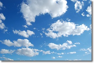
Weather Topic: What are Cumulonimbus Clouds?
Home - Education - Cloud Types - Cumulonimbus Clouds
 Next Topic: Cumulus Clouds
The final form taken by a growing cumulus cloud is the
cumulonimbus cloud, which is very tall and dense.
The tower of a cumulonimbus cloud can soar 23 km into the atmosphere, although
most commonly they stop growing at an altitude of 6 km.
Even small cumulonimbus clouds appear very large in comparison to other cloud types.
They can signal the approach of stormy weather, such as thunderstorms or blizzards.
Next Topic: Cumulus Clouds
Weather Topic: What is Drizzle?
Home - Education - Precipitation - Drizzle
 Next Topic: Evaporation
Drizzle is precipitation in the form of water droplets which are
smaller than raindrops.
Drizzle is characterized by fine, gently falling droplets and typically does not
impact human habitation in a negative way. The exception to this is freezing drizzle,
a condition where drizzle freezes immediately upon reaching earth's surface.
Freezing drizzle is still less dangerous than freezing rain, but can
potentially result in hazardous road conditions.
Next Topic: Evaporation
Current conditions powered by WeatherAPI.com


