Weather Alert in Kansas
Flood Watch issued August 27 at 2:30PM CDT until August 28 at 1:00PM CDT by NWS Wichita KS
AREAS AFFECTED: Ellsworth; Saline; Rice; McPherson; Marion; Chase; Reno; Harvey; Butler; Greenwood; Woodson; Allen; Sedgwick; Elk; Wilson; Neosho; Montgomery; Labette
DESCRIPTION: * WHAT...Flooding caused by excessive rainfall continues to be possible. * WHERE...Portions of Central, South Central, and Southeast Kansas, including the following counties, in Central Kansas, Chase, Ellsworth, Marion, McPherson, Rice and Saline. In South Central Kansas, Butler, Harvey, Reno and Sedgwick. In Southeast Kansas, Allen, Elk, Greenwood, Labette, Montgomery, Neosho, Wilson and Woodson. * WHEN...From 7 PM CDT this evening through Thursday afternoon. * IMPACTS...Excessive runoff may result in flooding of rivers, creeks, streams, and other low-lying and flood-prone locations. Low-water crossings may be flooded. * ADDITIONAL DETAILS... - A narrow zone of very heavy rainfall is expected to develop overnight into early Thursday morning along a Salina-to- Chanute line. Rainfall totals around 2 to 5 inches are currently being forecast with locally higher amounts possible. Though it has been relatively dry over the past 2 to 3 weeks, this amount of rainfall in a short amount of time could cause areas of localized flooding across the watch area.
INSTRUCTION: You should monitor later forecasts and be alert for possible Flood Warnings. Those living in areas prone to flooding should be prepared to take action should flooding develop. Be especially cautious at night when it is harder to recognize the dangers of flooding.
Want more detail? Get the Complete 7 Day and Night Detailed Forecast!
Current U.S. National Radar--Current
The Current National Weather Radar is shown below with a UTC Time (subtract 5 hours from UTC to get Eastern Time).

National Weather Forecast--Current
The Current National Weather Forecast and National Weather Map are shown below.

National Weather Forecast for Tomorrow
Tomorrow National Weather Forecast and Tomorrow National Weather Map are show below.

North America Water Vapor (Moisture)
This map shows recent moisture content over North America. Bright and colored areas show high moisture (ie, clouds); brown indicates very little moisture present; black indicates no moisture.

Weather Topic: What is Sleet?
Home - Education - Precipitation - Sleet
 Next Topic: Snow
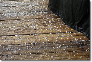
Sleet is a form of precipitation in which small ice pellets are the primary
components. These ice pellets are smaller and more translucent than hailstones,
and harder than graupel. Sleet is caused by specific atmospheric conditions and
therefore typically doesn't last for extended periods of time.
The condition which leads to sleet formation requires a warmer body of air to be
wedged in between two sub-freezing bodies of air. When snow falls through a warmer
layer of air it melts, and as it falls through the next sub-freezing body of air
it freezes again, forming ice pellets known as sleet. In some cases, water
droplets don't have time to freeze before reaching the surface and the result is
freezing rain.
Next Topic: Snow
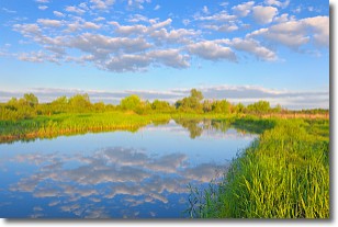
Weather Topic: What are Stratocumulus Clouds?
Home - Education - Cloud Types - Stratocumulus Clouds
 Next Topic: Stratus Clouds
Stratocumulus clouds are similar to altocumulus clouds in their
fluffy appearance, but have a slightly darker shade due to their additional mass.
A good way to distinguish the two cloud types is to hold your hand out and measure
the size of an individual cloud; if it is the size of your thumb it is generally
an altocumulus cloud, if it is the size of your hand it is generally a
stratocumulus cloud.
It is uncommon for stratocumulus clouds to produce precipitation, but if they do
it is usually a light rain or snow.
Next Topic: Stratus Clouds
Current conditions powered by WeatherAPI.com


