Weather Alert in Iowa
Winter Weather Advisory issued February 28 at 7:31AM CST until February 28 at 9:00PM CST by NWS La Crosse WI
AREAS AFFECTED: Howard; Winneshiek; Allamakee; Wabasha; Dodge; Olmsted; Winona; Mower; Fillmore; Houston; La Crosse; Monroe; Juneau; Adams; Vernon; Crawford; Richland
DESCRIPTION: ...A NARROW BAND OF SNOW TODAY... .A narrow band of snow will move in from the west this morning and then continue into late this afternoon or evening. Snowfall rates up to an inch per hour will be possible mainly from the late morning through the early afternoon where the narrow heavy snowfall band sets up, quickly accumulating on roadways. Snowfall amounts within the band will likely range between 2 to 4 inches with locally higher amounts possible (30%). A sharp cutoff in snowfall amounts to the north and south is expected. Therefore, any slight shift in storm track can still affect snowfall location and local impacts. As a result, be sure to continue to monitor the forecast for updates. * WHAT...Snow. Additional snow accumulations between 1 and 4 inches. Locally higher amounts will be possible. * WHERE...Portions of northeast Iowa, southeast Minnesota, and central, southwest, and west central Wisconsin. * WHEN...Until 9 PM CST this evening. * IMPACTS...Plan on slippery road conditions.
INSTRUCTION: Slow down and use caution while traveling. In Iowa, visit 511ia.org for road conditions. In Minnesota, visit 511mn.org for road conditions. In Wisconsin, visit 511wi.gov for road conditions.
Want more detail? Get the Complete 7 Day and Night Detailed Forecast!
Current U.S. National Radar--Current
The Current National Weather Radar is shown below with a UTC Time (subtract 5 hours from UTC to get Eastern Time).

National Weather Forecast--Current
The Current National Weather Forecast and National Weather Map are shown below.

National Weather Forecast for Tomorrow
Tomorrow National Weather Forecast and Tomorrow National Weather Map are show below.

North America Water Vapor (Moisture)
This map shows recent moisture content over North America. Bright and colored areas show high moisture (ie, clouds); brown indicates very little moisture present; black indicates no moisture.

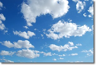
Weather Topic: What are Cumulonimbus Clouds?
Home - Education - Cloud Types - Cumulonimbus Clouds
 Next Topic: Cumulus Clouds
The final form taken by a growing cumulus cloud is the
cumulonimbus cloud, which is very tall and dense.
The tower of a cumulonimbus cloud can soar 23 km into the atmosphere, although
most commonly they stop growing at an altitude of 6 km.
Even small cumulonimbus clouds appear very large in comparison to other cloud types.
They can signal the approach of stormy weather, such as thunderstorms or blizzards.
Next Topic: Cumulus Clouds
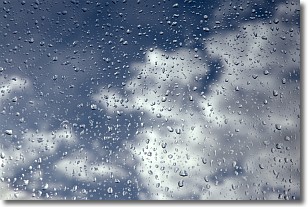
Weather Topic: What is Drizzle?
Home - Education - Precipitation - Drizzle
 Next Topic: Evaporation
Drizzle is precipitation in the form of water droplets which are
smaller than raindrops.
Drizzle is characterized by fine, gently falling droplets and typically does not
impact human habitation in a negative way. The exception to this is freezing drizzle,
a condition where drizzle freezes immediately upon reaching earth's surface.
Freezing drizzle is still less dangerous than freezing rain, but can
potentially result in hazardous road conditions.
Next Topic: Evaporation
Current conditions powered by WeatherAPI.com


