Weather Alert in California
Heat Advisory issued August 21 at 1:44AM PDT until August 23 at 9:00PM PDT by NWS San Francisco CA
AREAS AFFECTED: Southern Salinas Valley/Arroyo Seco and Lake San Antonio; Santa Lucia Mountains and Los Padres National Forest; Mountains Of San Benito County And Interior Monterey County Including Pinnacles National Park
DESCRIPTION: * WHAT...Daytime temperatures from the 90s to near 107 expected. Nighttime temperatures in the hills 60s to mid 70s. * WHERE...Interior Monterey County and the Santa Lucia Range, Interior San Benito County, and Southern Salinas Valley/Arroyo Seco and Lake San Antonio. * WHEN...From 10 AM this morning to 9 PM PDT Saturday. * IMPACTS...Hot conditions can cause heat illnesses. This level of heat affects most individuals sensitive to heat, especially those without effective cooling and/or adequate hydration. Impacts possible in some health systems and in heat-sensitive industries.
INSTRUCTION: Hydration is a critical piece to surviving the heat. Drink water, and if possible, take water to those who are vulnerable. Take extra precautions when outside. Wear lightweight and loose fitting clothing. Try to limit strenuous activities to the early morning or evening. Take action when you experience symptoms of heat exhaustion and/or heat stroke. Beat the heat and check the backseat! Do not leave young children or pets in unattended vehicles.
Want more detail? Get the Complete 7 Day and Night Detailed Forecast!
Current U.S. National Radar--Current
The Current National Weather Radar is shown below with a UTC Time (subtract 5 hours from UTC to get Eastern Time).

National Weather Forecast--Current
The Current National Weather Forecast and National Weather Map are shown below.

National Weather Forecast for Tomorrow
Tomorrow National Weather Forecast and Tomorrow National Weather Map are show below.

North America Water Vapor (Moisture)
This map shows recent moisture content over North America. Bright and colored areas show high moisture (ie, clouds); brown indicates very little moisture present; black indicates no moisture.

Weather Topic: What are Nimbostratus Clouds?
Home - Education - Cloud Types - Nimbostratus Clouds
 Next Topic: Precipitation
A nimbostratus cloud is similar to a stratus cloud in its formless,
smooth appearance. However, a nimbostratus cloud is darker than a stratus cloud,
because it is thicker.
Unlike a stratus cloud, a nimbostratus cloud typically brings with it the threat
of moderate to heavy precipitation. In some cases, the precipitation may evaporate
before reaching the ground, a phenomenon known as virga.
Next Topic: Precipitation
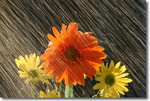
Weather Topic: What is Rain?
Home - Education - Precipitation - Rain
 Next Topic: Shelf Clouds
Precipitation in the form of water droplets is called rain.
Rain generally has a tendency to fall with less intensity over a greater period
of time, and when rainfall is more severe it is usually less sustained.
Rain is the most common form of precipitation and happens with greater frequency
depending on the season and regional influences. Cities have been shown to have
an observable effect on rainfall, due to an effect called the urban heat island.
Compared to upwind, monthly rainfall between twenty and forty miles downwind of
cities is 30% greater.
Next Topic: Shelf Clouds
Current conditions powered by WeatherAPI.com


