Weather Alert in Hawaii
Coastal Flood Statement issued September 3 at 3:03AM HST until September 7 at 6:00PM HST by NWS Honolulu HI
AREAS AFFECTED: Niihau; Kauai Southwest; Waianae Coast; Oahu North Shore; Olomana; Kahoolawe; Maui Windward West; Maui Leeward West; Kona; Kohala; Kauai North; Kauai East; Kauai South; East Honolulu; Honolulu Metro; Ewa Plain; Koolau Windward; Molokai Windward; Molokai Southeast; Molokai North; Molokai West; Molokai Leeward South; Lanai Windward; Lanai Leeward; Lanai South; Maui Central Valley North; Maui Central Valley South; Windward Haleakala; Kipahulu; South Maui/Upcountry; South Haleakala; Big Island South; Big Island Southeast; Big Island East; Big Island North
DESCRIPTION: ...MINOR COASTAL FLOODING DURING THE HIGH TIDE THROUGH SUNDAY AFTERNOON FOR LOW LYING COASTAL AREAS OF ALL ISLANDS... Peak high tides associated with the lunar cycle will lead to minor coastal flooding along shorelines and low lying coastal areas during the daily afternoon high tide through Sunday. * WHAT...Isolated minor coastal flooding expected. * WHERE...Vulnerable low-lying coastal roadways, docks, boat ramps, and other coastal infrastructure. * WHEN...Through the afternoon hours Wednesday through Sunday at and around the daily peak tides. * IMPACTS...Flooding of beaches that are normally dry, minor coastal erosion, and saltwater inundation.
INSTRUCTION: Avoid driving through flooded roadways. If you are forced to drive through salt water, be sure to rinse your vehicle with fresh water. Move electronics, vehicles or other valuables to higher ground. Monitor vessels to ensure mooring lines don't get too tight and watch out for overwash around boat ramps. Secure canoes or other watercraft stowed on beaches.
Want more detail? Get the Complete 7 Day and Night Detailed Forecast!
Current U.S. National Radar--Current
The Current National Weather Radar is shown below with a UTC Time (subtract 5 hours from UTC to get Eastern Time).

National Weather Forecast--Current
The Current National Weather Forecast and National Weather Map are shown below.

National Weather Forecast for Tomorrow
Tomorrow National Weather Forecast and Tomorrow National Weather Map are show below.

North America Water Vapor (Moisture)
This map shows recent moisture content over North America. Bright and colored areas show high moisture (ie, clouds); brown indicates very little moisture present; black indicates no moisture.

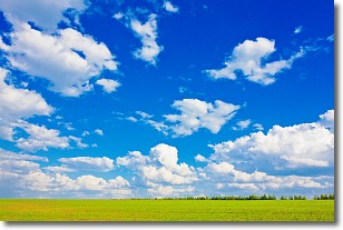
Weather Topic: What are Cumulus Clouds?
Home - Education - Cloud Types - Cumulus Clouds
 Next Topic: Drizzle
Cumulus clouds are fluffy and textured with rounded tops, and
may have flat bottoms. The border of a cumulus cloud
is clearly defined, and can have the appearance of cotton or cauliflower.
Cumulus clouds form at low altitudes (rarely above 2 km) but can grow very tall,
becoming cumulus congestus and possibly the even taller cumulonimbus clouds.
When cumulus clouds become taller, they have a greater chance of producing precipitation.
Next Topic: Drizzle
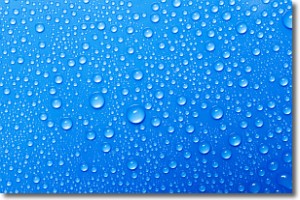
Weather Topic: What is Evaporation?
Home - Education - Precipitation - Evaporation
 Next Topic: Fog
Evaporation is the process which returns water from the earth
back to the atmosphere, and is another crucial process in the water cycle.
Evaporation is the transformation of liquid into gas, and it happens because
molecules are excited by the application of energy and turn into vapor.
In order for water to evaporate it has to be on the surface of a body of water.
Next Topic: Fog
Current conditions powered by WeatherAPI.com


