Weather Alert in Kansas
Flood Warning issued April 2 at 4:12AM CDT until April 3 at 5:06AM CDT by NWS Springfield MO
AREAS AFFECTED: Bourbon, KS
DESCRIPTION: ...The National Weather Service in Springfield MO has issued a Flood Warning for the following rivers in Kansas...Missouri... Little Osage River at Fulton affecting Bourbon County. Little Osage River near Horton affecting Vernon County. For the Little Osage River...including Fulton, Horton...Moderate flooding is forecast. * WHAT...Moderate flooding is forecast. * WHERE...Little Osage River at Fulton. * WHEN...Until late tonight. * IMPACTS...At 25.0 feet, Farmland at the gage site becomes covered by flood waters, and Highway 31, east of town becomes flooded. Highway 31, four miles west of Fulton has flood waters four to six feet in depth. * ADDITIONAL DETAILS... - At 3:45 AM CDT Thursday the stage was 19.7 feet. - Bankfull stage is 22.0 feet. - Forecast...The river is expected to rise above flood stage early this morning to a crest of 26.7 feet this afternoon. It will then fall below flood stage late this evening. - Flood stage is 22.0 feet. - Flood History...This crest compares to a previous crest of 26.7 feet on 04/21/1973. - http://www.weather.gov/safety/flood
INSTRUCTION: Turn around, don't drown when encountering flooded roads. Many flood deaths occur in vehicles. Additional information is available at www.weather.gov. The next statement will be issued late tonight at 415 AM CDT.
Want more detail? Get the Complete 7 Day and Night Detailed Forecast!
Current U.S. National Radar--Current
The Current National Weather Radar is shown below with a UTC Time (subtract 5 hours from UTC to get Eastern Time).

National Weather Forecast--Current
The Current National Weather Forecast and National Weather Map are shown below.

National Weather Forecast for Tomorrow
Tomorrow National Weather Forecast and Tomorrow National Weather Map are show below.

North America Water Vapor (Moisture)
This map shows recent moisture content over North America. Bright and colored areas show high moisture (ie, clouds); brown indicates very little moisture present; black indicates no moisture.

Weather Topic: What are Nimbostratus Clouds?
Home - Education - Cloud Types - Nimbostratus Clouds
 Next Topic: Precipitation
A nimbostratus cloud is similar to a stratus cloud in its formless,
smooth appearance. However, a nimbostratus cloud is darker than a stratus cloud,
because it is thicker.
Unlike a stratus cloud, a nimbostratus cloud typically brings with it the threat
of moderate to heavy precipitation. In some cases, the precipitation may evaporate
before reaching the ground, a phenomenon known as virga.
Next Topic: Precipitation
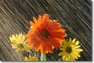
Weather Topic: What is Rain?
Home - Education - Precipitation - Rain
 Next Topic: Shelf Clouds
Precipitation in the form of water droplets is called rain.
Rain generally has a tendency to fall with less intensity over a greater period
of time, and when rainfall is more severe it is usually less sustained.
Rain is the most common form of precipitation and happens with greater frequency
depending on the season and regional influences. Cities have been shown to have
an observable effect on rainfall, due to an effect called the urban heat island.
Compared to upwind, monthly rainfall between twenty and forty miles downwind of
cities is 30% greater.
Next Topic: Shelf Clouds
Current conditions powered by WeatherAPI.com


