Weather Alert in California
Special Weather Statement issued July 30 at 8:23PM PDT by NWS Eureka CA
AREAS AFFECTED: Coastal Del Norte
DESCRIPTION: ...TSUNAMI ADVISORY IS IN EFFECT FOR THE DEL NORTE COAST... * UPDATES... There have been no significant changes since the last statement. * LOCAL IMPACTs...A tsunami capable of producing strong currents that are hazardous to swimmers, boats, and coastal structures is occurring. Widespread inundation is NOT expected. Some damage to the Crescent City harbor was reported. Note: High tide is occurring now and this will bring higher water levels. * RECOMMENDED ACTIONS... If you are located in this coastal area, move off the beach and out of harbors and marinas. Do not go to the coast to watch the tsunami. Be alert to instructions from your local emergency officials. Tsunamis are a series of waves or surges which can be dangerous for many hours after the first wave arrival. * OBSERVED TSUNAMI WAVE HEIGHTS FROM EARLIER... Crescent City California 2.7 to 4.0 ft. * PRELIMINARY EARTHQUAKE INFORMATION... An earthquake occurred at 425 PM PDT on Jul 29 2025, with a preliminary magnitude of 8.8 centered 315 miles SW of Bering Island, Komandorski at a depth of 46 miles. * TIDE INFORMATION... Humboldt Bay North Spit...Low tides of 2.1 ft at 935 AM PDT on Jul 31, and 1.7 ft at 1110 PM PDT on Jul 31. High tides of 4.7 ft at 358 AM PDT on Jul 31, and 6.3 ft at 419 PM PDT on Jul 31. Crescent City Harbor...Low tides of 2.1 ft at 927 AM PDT on Jul 31, and 1.6 ft at 1104 PM PDT on Jul 31. High tides of 4.7 ft at 349 AM PDT on Jul 31, and 6.3 ft at 405 PM PDT on Jul 31. This product will be updated as new information becomes available. Stay tuned to your local news source and NOAA weather radio for further information and updates.
INSTRUCTION: N/A
Want more detail? Get the Complete 7 Day and Night Detailed Forecast!
Current U.S. National Radar--Current
The Current National Weather Radar is shown below with a UTC Time (subtract 5 hours from UTC to get Eastern Time).

National Weather Forecast--Current
The Current National Weather Forecast and National Weather Map are shown below.

National Weather Forecast for Tomorrow
Tomorrow National Weather Forecast and Tomorrow National Weather Map are show below.

North America Water Vapor (Moisture)
This map shows recent moisture content over North America. Bright and colored areas show high moisture (ie, clouds); brown indicates very little moisture present; black indicates no moisture.

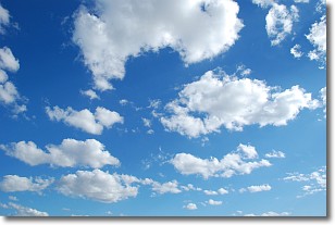
Weather Topic: What are Cumulonimbus Clouds?
Home - Education - Cloud Types - Cumulonimbus Clouds
 Next Topic: Cumulus Clouds
The final form taken by a growing cumulus cloud is the
cumulonimbus cloud, which is very tall and dense.
The tower of a cumulonimbus cloud can soar 23 km into the atmosphere, although
most commonly they stop growing at an altitude of 6 km.
Even small cumulonimbus clouds appear very large in comparison to other cloud types.
They can signal the approach of stormy weather, such as thunderstorms or blizzards.
Next Topic: Cumulus Clouds
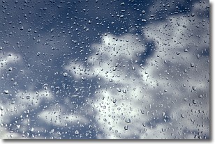
Weather Topic: What is Drizzle?
Home - Education - Precipitation - Drizzle
 Next Topic: Evaporation
Drizzle is precipitation in the form of water droplets which are
smaller than raindrops.
Drizzle is characterized by fine, gently falling droplets and typically does not
impact human habitation in a negative way. The exception to this is freezing drizzle,
a condition where drizzle freezes immediately upon reaching earth's surface.
Freezing drizzle is still less dangerous than freezing rain, but can
potentially result in hazardous road conditions.
Next Topic: Evaporation
Current conditions powered by WeatherAPI.com


