Weather Alert in Colorado
Winter Weather Advisory issued February 16 at 2:02AM MST until February 18 at 11:00PM MST by NWS Pueblo CO
AREAS AFFECTED: Western Mosquito Range/East Lake County Above 11000 Ft; Leadville Vicinity/Lake County Below 11000 Ft; Western Chaffee County Between 9000 and 11000 Ft; La Garita Mountains Above 10000 Ft; Upper Rio Grande Valley/Eastern San Juan Mountains Below 10000 Ft
DESCRIPTION: * WHAT...Snow expected. Total snow accumulations between 4 and 12 inches. Winds gusting as high as 75 mph across the higher peaks and lower east facing slopes at times. * WHERE...La Garita Mountains Above 10000 Feet, Central Lake County Below 11000 Feet, Western Chaffee County Between 9000 and 11000 Feet, Western Mosquito Range Above 11000 Feet, and Upper Rio Grande Valley and the Eastern San Juan Mountains Below 10000 Feet. * WHEN...From 11 PM this evening to 11 PM MST Wednesday. * IMPACTS...Travel could be very difficult to impossible. Very strong winds could cause power outages and tree damage.
INSTRUCTION: Slow down and use caution while traveling. The latest road conditions for the state you are calling from can be obtained by calling 5 1 1.
Want more detail? Get the Complete 7 Day and Night Detailed Forecast!
Current U.S. National Radar--Current
The Current National Weather Radar is shown below with a UTC Time (subtract 5 hours from UTC to get Eastern Time).

National Weather Forecast--Current
The Current National Weather Forecast and National Weather Map are shown below.

National Weather Forecast for Tomorrow
Tomorrow National Weather Forecast and Tomorrow National Weather Map are show below.

North America Water Vapor (Moisture)
This map shows recent moisture content over North America. Bright and colored areas show high moisture (ie, clouds); brown indicates very little moisture present; black indicates no moisture.

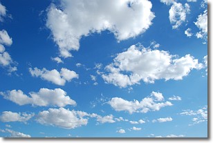
Weather Topic: What are Cumulonimbus Clouds?
Home - Education - Cloud Types - Cumulonimbus Clouds
 Next Topic: Cumulus Clouds
The final form taken by a growing cumulus cloud is the
cumulonimbus cloud, which is very tall and dense.
The tower of a cumulonimbus cloud can soar 23 km into the atmosphere, although
most commonly they stop growing at an altitude of 6 km.
Even small cumulonimbus clouds appear very large in comparison to other cloud types.
They can signal the approach of stormy weather, such as thunderstorms or blizzards.
Next Topic: Cumulus Clouds
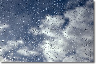
Weather Topic: What is Drizzle?
Home - Education - Precipitation - Drizzle
 Next Topic: Evaporation
Drizzle is precipitation in the form of water droplets which are
smaller than raindrops.
Drizzle is characterized by fine, gently falling droplets and typically does not
impact human habitation in a negative way. The exception to this is freezing drizzle,
a condition where drizzle freezes immediately upon reaching earth's surface.
Freezing drizzle is still less dangerous than freezing rain, but can
potentially result in hazardous road conditions.
Next Topic: Evaporation
Current conditions powered by WeatherAPI.com


