Weather Alert in Idaho
Winter Weather Advisory issued February 15 at 12:17PM MST until February 17 at 5:00PM MST by NWS Missoula MT
AREAS AFFECTED: Western Lemhi County; Eastern Lemhi County
DESCRIPTION: * WHAT...Snow expected. There is a likelihood moderate winter weather impacts. Total snow accumulations of 3 to 6 inches across area mountain passes, with up to 1 inch in lower elevations such as Salmon. * WHERE...Highway 93 Lost Trail Pass to Gibbonsville, Salmon, Shoup, Bannock Pass, Highway 28 Tendoy to Lone Pine, Williams Creek Summit, and Lemhi Pass. * WHEN...From 2 AM to 5 PM MST Tuesday. * IMPACTS...For MODERATE winter weather impacts, expect disruptions to normal activities. Hazardous traveling conditions. Use extra caution while driving. Closures and disruptions to infrastructure may occur. The hazardous conditions could impact the Tuesday morning and evening commutes, especially over higher passes. * ADDITIONAL DETAILS...Falling temperatures and snow levels will bring snow to elevations below 3,000 feet Tuesday morning. The cold front will bring an elevated risk for snow squalls capable of producing bursts of heavy snow and gusty winds across mountain areas, leading to brief whiteout conditions.
INSTRUCTION: Slow down and use caution while traveling. The latest road conditions for the state you are calling from can be obtained by calling 5 1 1.
Want more detail? Get the Complete 7 Day and Night Detailed Forecast!
Current U.S. National Radar--Current
The Current National Weather Radar is shown below with a UTC Time (subtract 5 hours from UTC to get Eastern Time).

National Weather Forecast--Current
The Current National Weather Forecast and National Weather Map are shown below.

National Weather Forecast for Tomorrow
Tomorrow National Weather Forecast and Tomorrow National Weather Map are show below.

North America Water Vapor (Moisture)
This map shows recent moisture content over North America. Bright and colored areas show high moisture (ie, clouds); brown indicates very little moisture present; black indicates no moisture.

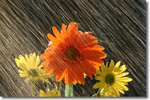
Weather Topic: What is Rain?
Home - Education - Precipitation - Rain
 Next Topic: Shelf Clouds
Precipitation in the form of water droplets is called rain.
Rain generally has a tendency to fall with less intensity over a greater period
of time, and when rainfall is more severe it is usually less sustained.
Rain is the most common form of precipitation and happens with greater frequency
depending on the season and regional influences. Cities have been shown to have
an observable effect on rainfall, due to an effect called the urban heat island.
Compared to upwind, monthly rainfall between twenty and forty miles downwind of
cities is 30% greater.
Next Topic: Shelf Clouds
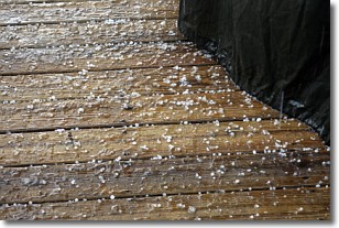
Weather Topic: What is Sleet?
Home - Education - Precipitation - Sleet
 Next Topic: Snow
Sleet is a form of precipitation in which small ice pellets are the primary
components. These ice pellets are smaller and more translucent than hailstones,
and harder than graupel. Sleet is caused by specific atmospheric conditions and
therefore typically doesn't last for extended periods of time.
The condition which leads to sleet formation requires a warmer body of air to be
wedged in between two sub-freezing bodies of air. When snow falls through a warmer
layer of air it melts, and as it falls through the next sub-freezing body of air
it freezes again, forming ice pellets known as sleet. In some cases, water
droplets don't have time to freeze before reaching the surface and the result is
freezing rain.
Next Topic: Snow
Current conditions powered by WeatherAPI.com


