Weather Alert in Alaska
Winter Weather Advisory issued February 12 at 2:48PM AKST until February 14 at 9:00AM AKST by NWS Anchorage AK
AREAS AFFECTED: Kuskokwim Delta Coast and Nunivak Island; Interior Kuskokwim Delta; Western Capes
DESCRIPTION: * WHAT...Blizzard conditions may continue through 5pm, but conditions are expected to improve quickly this afternoon. A wintry mix is expected Friday and into Saturday with snow eventually becoming rain. * WHERE...Kuskokwim Delta, and Western Capes. * WHEN...From 9 AM Friday to 9 AM AKST Saturday. * IMPACTS...Areas of snow and blowing snow could significantly reduce visibility. Snow becoming rain could make travel very difficult. * ADDITIONAL DETAILS...A complex weather system will move through the region Friday and into Saturday. Friday morning will see snow, followed by rain and snow Friday evening along the coast. After a brief lull in activity, snow and rain will pick up overnight Friday, eventually turning into rain, south of the Kuskokwim river. North of the river, potentially heavy snow may fall with 1 inch an hour rates. Complexity of the weather may mean the dividing line between rain and snow may shift as time continues. Please stay tuned into the forecast for the latest.
INSTRUCTION: Use caution if travel is necessary.
Want more detail? Get the Complete 7 Day and Night Detailed Forecast!
Current U.S. National Radar--Current
The Current National Weather Radar is shown below with a UTC Time (subtract 5 hours from UTC to get Eastern Time).

National Weather Forecast--Current
The Current National Weather Forecast and National Weather Map are shown below.

National Weather Forecast for Tomorrow
Tomorrow National Weather Forecast and Tomorrow National Weather Map are show below.

North America Water Vapor (Moisture)
This map shows recent moisture content over North America. Bright and colored areas show high moisture (ie, clouds); brown indicates very little moisture present; black indicates no moisture.

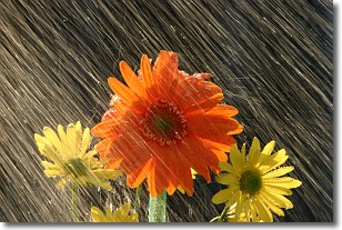
Weather Topic: What is Rain?
Home - Education - Precipitation - Rain
 Next Topic: Shelf Clouds
Precipitation in the form of water droplets is called rain.
Rain generally has a tendency to fall with less intensity over a greater period
of time, and when rainfall is more severe it is usually less sustained.
Rain is the most common form of precipitation and happens with greater frequency
depending on the season and regional influences. Cities have been shown to have
an observable effect on rainfall, due to an effect called the urban heat island.
Compared to upwind, monthly rainfall between twenty and forty miles downwind of
cities is 30% greater.
Next Topic: Shelf Clouds
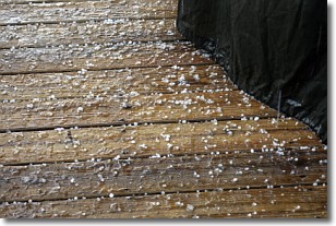
Weather Topic: What is Sleet?
Home - Education - Precipitation - Sleet
 Next Topic: Snow
Sleet is a form of precipitation in which small ice pellets are the primary
components. These ice pellets are smaller and more translucent than hailstones,
and harder than graupel. Sleet is caused by specific atmospheric conditions and
therefore typically doesn't last for extended periods of time.
The condition which leads to sleet formation requires a warmer body of air to be
wedged in between two sub-freezing bodies of air. When snow falls through a warmer
layer of air it melts, and as it falls through the next sub-freezing body of air
it freezes again, forming ice pellets known as sleet. In some cases, water
droplets don't have time to freeze before reaching the surface and the result is
freezing rain.
Next Topic: Snow
Current conditions powered by WeatherAPI.com


