Weather Alert in California
Winter Storm Warning issued February 15 at 8:11PM PST until February 19 at 9:00AM PST by NWS San Diego CA
AREAS AFFECTED: Riverside County Mountains
DESCRIPTION: * WHAT...Heavy snow expected. For first round Monday, 3-6 inches expected between 6000-7000 ft, 6-12 inches expected above 7000 ft, up to 24 inches above 8000 ft. West winds gusting to 55 mph on the ridges and desert slopes. Occasional light snow during the day Tuesday. Next round of moderate snow Wednesday into Thursday morning with additional snow totals of 4-9 inches 6000-7000 ft, and up to 12 inches above 8000 ft. Wind gusts as high as 70 mph possible on the desert slopes of the mountains late Tuesday and Wednesday. A few additional inches of snow expected Thursday. * WHERE...Riverside County Mountains. * WHEN...From 10 AM Monday to 9 AM PST Thursday. * IMPACTS...Travel could be very difficult to impossible. The hazardous conditions could impact the Monday evening and Tuesday morning commutes. Very strong winds could cause extensive tree damage. * ADDITIONAL DETAILS...For the first round Monday, snow levels will start around 7000 ft and fall to near 5000 ft. Lower snow levels near 4,000 feet possible Wednesday morning and Thursday.
INSTRUCTION: If you must travel, keep an extra flashlight, food, and water in your vehicle in case of an emergency. The latest road conditions for the state you are calling from can be obtained by calling 5 1 1.
Want more detail? Get the Complete 7 Day and Night Detailed Forecast!
Current U.S. National Radar--Current
The Current National Weather Radar is shown below with a UTC Time (subtract 5 hours from UTC to get Eastern Time).

National Weather Forecast--Current
The Current National Weather Forecast and National Weather Map are shown below.

National Weather Forecast for Tomorrow
Tomorrow National Weather Forecast and Tomorrow National Weather Map are show below.

North America Water Vapor (Moisture)
This map shows recent moisture content over North America. Bright and colored areas show high moisture (ie, clouds); brown indicates very little moisture present; black indicates no moisture.

Weather Topic: What are Stratus Clouds?
Home - Education - Cloud Types - Stratus Clouds
 Next Topic: Wall Clouds
Stratus clouds are similar to altostratus clouds, but form at a
lower altitude and are identified by their fog-like appearance, lacking the
distinguishing features of most clouds.
Stratus clouds are wider than most clouds, and their base has a smooth, uniform
look which is lighter in color than a nimbostratus cloud.
The presence of a stratus cloud indicates the possibility of minor precipitation,
such as drizzle, but heavier precipitation does not typically arrive in the form
of a stratus cloud.
Next Topic: Wall Clouds
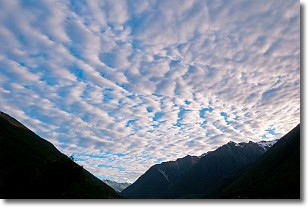
Weather Topic: What are Altocumulus Clouds?
Home - Education - Cloud Types - Altocumulus Clouds
 Next Topic: Altostratus Clouds
Similar to cirrocumulus clouds, altocumulus clouds are
characterized by cloud patches. They are distinguished by larger cloudlets
than cirrocumulus clouds but are still smaller than stratocumulus clouds.
Altocumulus clouds most commonly form in middle altitudes (between 2 and 5 km)
and may resemble, at times, the shape of a flying saucer.
These uncommon formations, called altocumulus lenticularis, are created by uplift
in the atmosphere and are most often seen in close proximity to mountains.
Next Topic: Altostratus Clouds
Current conditions powered by WeatherAPI.com


