Weather Alert in California
Flash Flood Warning issued February 16 at 1:48PM PST until February 16 at 4:00PM PST by NWS Los Angeles/Oxnard CA
AREAS AFFECTED: Los Angeles, CA
DESCRIPTION: FFWLOX The National Weather Service in Los Angeles/Oxnard has extended the * Flash Flood Warning for... Southeastern Los Angeles County in southwestern California... * Until 400 PM PST. * At 148 PM PST, local law enforcement reported flash flooding already developing from heavy showers and thunderstorms across the warned area. Flash flooding is already occurring. Rock slides and mud slides are expected. Debris flows on the burn scars. HAZARD...Life threatening flash flooding. Thunderstorms producing flash flooding. Significant rock slides and mud slides. Debris flows. SOURCE...Law enforcement reported. IMPACT...Life threatening flash flooding of creeks and streams, urban areas, highways, streets and underpasses. Significant rock slides and mud slides. Debris flows. * Some locations that will experience flash flooding include... Alhambra, Downtown Los Angeles, Pasadena, Griffith Park, Hollywood, Burbank, Universal City, Mount Wilson, Inglewood, Beverly Hills, Whittier, Culver City, North Hollywood, Altadena, Eagle Rock, Glendale, La Canada Flintridge, Hancock Park, Hollywood Hills and Toluca Lake. Burn scars, such as Eaton and eastern Palisades.
INSTRUCTION: Turn around, don't drown when encountering flooded roads. Most flood deaths occur in vehicles. Be aware of your surroundings and do not drive on flooded roads, and be aware of rock slides and mud slides around high terrain. Follow direction of Emergency Management and Law Enforcement officials.
Want more detail? Get the Complete 7 Day and Night Detailed Forecast!
Current U.S. National Radar--Current
The Current National Weather Radar is shown below with a UTC Time (subtract 5 hours from UTC to get Eastern Time).

National Weather Forecast--Current
The Current National Weather Forecast and National Weather Map are shown below.

National Weather Forecast for Tomorrow
Tomorrow National Weather Forecast and Tomorrow National Weather Map are show below.

North America Water Vapor (Moisture)
This map shows recent moisture content over North America. Bright and colored areas show high moisture (ie, clouds); brown indicates very little moisture present; black indicates no moisture.

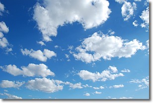
Weather Topic: What are Cumulonimbus Clouds?
Home - Education - Cloud Types - Cumulonimbus Clouds
 Next Topic: Cumulus Clouds
The final form taken by a growing cumulus cloud is the
cumulonimbus cloud, which is very tall and dense.
The tower of a cumulonimbus cloud can soar 23 km into the atmosphere, although
most commonly they stop growing at an altitude of 6 km.
Even small cumulonimbus clouds appear very large in comparison to other cloud types.
They can signal the approach of stormy weather, such as thunderstorms or blizzards.
Next Topic: Cumulus Clouds
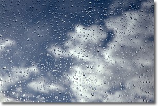
Weather Topic: What is Drizzle?
Home - Education - Precipitation - Drizzle
 Next Topic: Evaporation
Drizzle is precipitation in the form of water droplets which are
smaller than raindrops.
Drizzle is characterized by fine, gently falling droplets and typically does not
impact human habitation in a negative way. The exception to this is freezing drizzle,
a condition where drizzle freezes immediately upon reaching earth's surface.
Freezing drizzle is still less dangerous than freezing rain, but can
potentially result in hazardous road conditions.
Next Topic: Evaporation
Current conditions powered by WeatherAPI.com


