Weather Alert in Oregon
Air Quality Alert issued August 22 at 4:03PM PDT by NWS Portland OR
AREAS AFFECTED: Tualatin Valley; West Hills and Chehalem Mountains; Inner Portland Metro; East Portland Metro; West Central Willamette Valley; East Central Willamette Valley; Benton County Lowlands; Linn County Lowlands; Lane County Lowlands
DESCRIPTION: The Oregon Department of Environmental Quality, and the Lane Regional Air Protection Agency have continued an Air Quality Advisory, which is IN EFFECT FROM 10 AM SATURDAY TO 8 PM PDT MONDAY. An Air Quality Advisory for Ozone remains in effect. High levels of ozone in the lower atmosphere in the region combined with forecasted conditions will cause air quality to reach unhealthy levels at times through Monday evening. Pollutants can cause burning eyes, runny nose, aggravate heart and lung diseases, and aggravate other serious health problems. Limit outdoor activities and keep children indoors. Please follow medical advice if you have a heart or lung condition. More information about air quality can be found at: www.orcaa.org www.swcleanair.gov www.oregon.gov/DEQ www.lrapa.org
INSTRUCTION: N/A
Want more detail? Get the Complete 7 Day and Night Detailed Forecast!
Current U.S. National Radar--Current
The Current National Weather Radar is shown below with a UTC Time (subtract 5 hours from UTC to get Eastern Time).

National Weather Forecast--Current
The Current National Weather Forecast and National Weather Map are shown below.

National Weather Forecast for Tomorrow
Tomorrow National Weather Forecast and Tomorrow National Weather Map are show below.

North America Water Vapor (Moisture)
This map shows recent moisture content over North America. Bright and colored areas show high moisture (ie, clouds); brown indicates very little moisture present; black indicates no moisture.

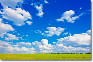
Weather Topic: What are Cumulus Clouds?
Home - Education - Cloud Types - Cumulus Clouds
 Next Topic: Drizzle
Cumulus clouds are fluffy and textured with rounded tops, and
may have flat bottoms. The border of a cumulus cloud
is clearly defined, and can have the appearance of cotton or cauliflower.
Cumulus clouds form at low altitudes (rarely above 2 km) but can grow very tall,
becoming cumulus congestus and possibly the even taller cumulonimbus clouds.
When cumulus clouds become taller, they have a greater chance of producing precipitation.
Next Topic: Drizzle
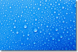
Weather Topic: What is Evaporation?
Home - Education - Precipitation - Evaporation
 Next Topic: Fog
Evaporation is the process which returns water from the earth
back to the atmosphere, and is another crucial process in the water cycle.
Evaporation is the transformation of liquid into gas, and it happens because
molecules are excited by the application of energy and turn into vapor.
In order for water to evaporate it has to be on the surface of a body of water.
Next Topic: Fog
Current conditions powered by WeatherAPI.com


