Weather Alert in Alaska
Winter Storm Watch issued February 12 at 1:33PM AKST until February 15 at 9:00PM AKST by NWS Fairbanks AK
AREAS AFFECTED: White Mountains and High Terrain South of the Yukon River; Upper Chena River Valley; Tanana Flats; Eielson AFB and Salcha; Goldstream Valley and Nenana Hills; Chatanika River Valley; Two Rivers; Fairbanks Metro Area; Nenana; Central Interior; Northern Denali Borough
DESCRIPTION: * WHAT...Heavy snow possible. Total snow accumulations in excess of 6 inches possible. * WHERE...Central Interior, Chatanika River Valley, Eielson AFB and Salcha, Fairbanks Metro Area, Goldstream Valley and Nenana Hills, Nenana, Northern Denali Borough, Tanana Flats, Two Rivers, Upper Chena River Valley, and White Mountains and High Terrain South of the Yukon River. * WHEN...From late Friday night through Sunday evening. * IMPACTS...Travel could be very difficult. * ADDITIONAL DETAILS...The bulk of the snow will fall on Saturday, though there will be another round of light and fluffy snow on Sunday. 4 to 8 inches of snow is possible on Saturday with another 2 to 4 inches possible on Sunday. Winds will be gusty Saturday night with gusts up to 50 mph in the terrain around Fairbanks, and up to 25 mph in Fairbanks.
INSTRUCTION: Monitor the latest forecasts for updates on this situation.
Want more detail? Get the Complete 7 Day and Night Detailed Forecast!
Current U.S. National Radar--Current
The Current National Weather Radar is shown below with a UTC Time (subtract 5 hours from UTC to get Eastern Time).

National Weather Forecast--Current
The Current National Weather Forecast and National Weather Map are shown below.

National Weather Forecast for Tomorrow
Tomorrow National Weather Forecast and Tomorrow National Weather Map are show below.

North America Water Vapor (Moisture)
This map shows recent moisture content over North America. Bright and colored areas show high moisture (ie, clouds); brown indicates very little moisture present; black indicates no moisture.

Weather Topic: What is Evaporation?
Home - Education - Precipitation - Evaporation
 Next Topic: Fog
Evaporation is the process which returns water from the earth
back to the atmosphere, and is another crucial process in the water cycle.
Evaporation is the transformation of liquid into gas, and it happens because
molecules are excited by the application of energy and turn into vapor.
In order for water to evaporate it has to be on the surface of a body of water.
Next Topic: Fog
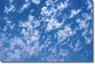
Weather Topic: What are Fractus Clouds?
Home - Education - Cloud Types - Fractus Clouds
 Next Topic: Freezing Rain
A fractus cloud (scud) is a fragmented, tattered cloud which has
likely been sheared off of another cloud. They are accessory clouds, meaning they
develop from parent clouds, and are named in a way which describes the original
cloud which contained them.
Fractus clouds which have originated from cumulus clouds are referred to as
cumulus fractus, while fractus clouds which have originated from stratus clouds
are referred to as stratus fractus. Under certain conditions a fractus cloud might
merge with another cloud, or develop into a cumulus cloud, but usually a
fractus cloud seen by itself will dissipate rapidly.
They are often observed on the leading and trailing edges of storm clouds,
and are a display of wind activity.
Next Topic: Freezing Rain
Current conditions powered by WeatherAPI.com


