Weather Alert in Michigan
Winter Weather Advisory issued February 22 at 2:22PM EST until February 23 at 11:00AM EST by NWS Gaylord MI
AREAS AFFECTED: Presque Isle; Leelanau; Alpena; Benzie; Grand Traverse; Alcona; Manistee
DESCRIPTION: * WHAT...Snow. Additional snow accumulations up to 3 inches, locally as high as 4-5 inches. North winds gusting as high as 35 mph. * WHERE...Parts of northern Lower Michigan near the Lake Michigan and Lake Huron coasts. * WHEN...Until 11 AM EST Monday. * IMPACTS...Roads, and especially bridges and overpasses, could become snow-covered and hazardous, particularly with falling and blowing snow. Prepare for reduced visibilities and slick road conditions. The hazardous conditions could impact the Monday morning commute. * ADDITIONAL DETAILS...North to north-northwest winds will have the greatest impacts on roads oriented largely east-to-west, including the US-23 corridor between Cheboygan and Alpena.
INSTRUCTION: Slow down and use caution while traveling. Plan to leave extra travel time for the Monday morning commute.
Want more detail? Get the Complete 7 Day and Night Detailed Forecast!
Current U.S. National Radar--Current
The Current National Weather Radar is shown below with a UTC Time (subtract 5 hours from UTC to get Eastern Time).

National Weather Forecast--Current
The Current National Weather Forecast and National Weather Map are shown below.

National Weather Forecast for Tomorrow
Tomorrow National Weather Forecast and Tomorrow National Weather Map are show below.

North America Water Vapor (Moisture)
This map shows recent moisture content over North America. Bright and colored areas show high moisture (ie, clouds); brown indicates very little moisture present; black indicates no moisture.

Weather Topic: What is Condensation?
Home - Education - Precipitation - Condensation
 Next Topic: Contrails
Condensation is the process which creates clouds, and therefore
it is a crucial process in the water cycle.
Condensation is the change of matter from a state of gas into a state of liquid,
and it happens because water molecules release heat into the atmosphere and
become organized into a more closely packed structure, what we might see as
water droplets.
Water is always present in the air around us as a vapor, but it's too small for
us to see. When water undergoes the process of condensation it becomes organized
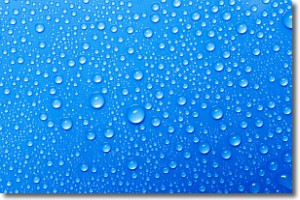
into visible water droplets. You've probably seen condensation happen before on the
surface of a cold drink!
Next Topic: Contrails
Weather Topic: What are Cumulonimbus Clouds?
Home - Education - Cloud Types - Cumulonimbus Clouds
 Next Topic: Cumulus Clouds
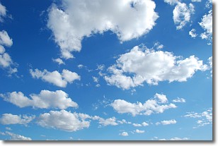
The final form taken by a growing cumulus cloud is the
cumulonimbus cloud, which is very tall and dense.
The tower of a cumulonimbus cloud can soar 23 km into the atmosphere, although
most commonly they stop growing at an altitude of 6 km.
Even small cumulonimbus clouds appear very large in comparison to other cloud types.
They can signal the approach of stormy weather, such as thunderstorms or blizzards.
Next Topic: Cumulus Clouds
Current conditions powered by WeatherAPI.com


