Weather Alert in Colorado
Fire Weather Watch issued February 24 at 12:18PM MST until February 25 at 7:00PM MST by NWS Goodland KS
AREAS AFFECTED: Kit Carson County; Cheyenne; Dundy
DESCRIPTION: ...Strong Winds Expected Wednesday... .Strong westerly winds will spread over the plains of Colorado and adjacent areas Wednesday afternoon. Strong winds, combined with very dry fuels will promote explosive fire growth. A strong cold front is expected to sweep across the area around sunset, shifting winds to the north-northeast making any ongoing fire control efforts difficult. The National Weather Service in Goodland has issued a Fire Weather Watch for wind and low relative humidity, which is in effect from Wednesday morning through Wednesday evening. * AFFECTED AREA...Fire Weather Zones 001 Cheyenne KS, 079 Dundy and 253 Kit Carson. * TIMING...From Wednesday morning through Wednesday evening. * WINDS...Northwest 15 to 25 mph with gusts up to 45 mph. * RELATIVE HUMIDITY...As low as 15 percent. * IMPACTS...Unpredictable fire behavior. Any fires that develop may rapidly grow and spread out of control.
INSTRUCTION: A Fire Weather Watch means that critical fire weather conditions are forecast to occur. Listen for later forecasts and possible red flag warnings.
Want more detail? Get the Complete 7 Day and Night Detailed Forecast!
Current U.S. National Radar--Current
The Current National Weather Radar is shown below with a UTC Time (subtract 5 hours from UTC to get Eastern Time).

National Weather Forecast--Current
The Current National Weather Forecast and National Weather Map are shown below.

National Weather Forecast for Tomorrow
Tomorrow National Weather Forecast and Tomorrow National Weather Map are show below.

North America Water Vapor (Moisture)
This map shows recent moisture content over North America. Bright and colored areas show high moisture (ie, clouds); brown indicates very little moisture present; black indicates no moisture.

Weather Topic: What are Nimbostratus Clouds?
Home - Education - Cloud Types - Nimbostratus Clouds
 Next Topic: Precipitation
A nimbostratus cloud is similar to a stratus cloud in its formless,
smooth appearance. However, a nimbostratus cloud is darker than a stratus cloud,
because it is thicker.
Unlike a stratus cloud, a nimbostratus cloud typically brings with it the threat
of moderate to heavy precipitation. In some cases, the precipitation may evaporate
before reaching the ground, a phenomenon known as virga.
Next Topic: Precipitation
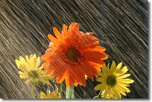
Weather Topic: What is Rain?
Home - Education - Precipitation - Rain
 Next Topic: Shelf Clouds
Precipitation in the form of water droplets is called rain.
Rain generally has a tendency to fall with less intensity over a greater period
of time, and when rainfall is more severe it is usually less sustained.
Rain is the most common form of precipitation and happens with greater frequency
depending on the season and regional influences. Cities have been shown to have
an observable effect on rainfall, due to an effect called the urban heat island.
Compared to upwind, monthly rainfall between twenty and forty miles downwind of
cities is 30% greater.
Next Topic: Shelf Clouds
Current conditions powered by WeatherAPI.com


