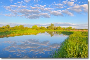
Weather Alert in Arkansas
Flood Watch issued May 19 at 2:12PM CDT until May 20 at 10:00AM CDT by NWS Little Rock AR
AREAS AFFECTED: Marion; Baxter; Fulton; Sharp; Randolph; Stone; Izard; Independence; Lawrence; Cleburne; Conway; Perry; Boone County Except Southwest; Newton County Higher Elevations; Searcy County Lower Elevations; Southern Johnson County; Southern Pope County; Southeast Van Buren County; Western and Northern Logan County; Northern Scott County; Northwest Yell County; Polk County Lower Elevations; Central and Eastern Montgomery County; Boone County Higher Elevations; Newton County Lower Elevations; Northwest Searcy County Higher Elevations; Johnson County Higher Elevations; Pope County Higher Elevations; Van Buren County Higher Elevations; Southern and Eastern Logan County; Central and Southern Scott County; Yell Excluding Northwest; Northern Polk County Higher Elevations; Northern Montgomery County Higher Elevations; Eastern, Central, and Southern Searcy County Higher Elevations; Southeast Polk County Higher Elevations; Southwest Montgomery County Higher Elevations
DESCRIPTION: * WHAT...Flash flooding caused by excessive rainfall continues to be possible. * WHERE...Portions of central, eastern, north central, and western Arkansas, including the following areas, in central Arkansas, Conway, Northwest Yell County, Perry, Pope County Higher Elevations, Southern Pope County and Yell Excluding Northwest. In eastern Arkansas, Lawrence and Randolph. In north central Arkansas, Baxter, Boone County Except Southwest, Boone County Higher Elevations, Cleburne, Eastern, Central, and Southern Searcy County Higher Elevations, Fulton, Independence, Izard, Marion, Newton County Higher Elevations, Newton County Lower Elevations, Northwest Searcy County Higher Elevations, Searcy County Lower Elevations, Sharp, Southeast Van Buren County, Stone and Van Buren County Higher Elevations. In western Arkansas, Central and Eastern Montgomery County, Central and Southern Scott County, Johnson County Higher Elevations, Northern Montgomery County Higher Elevations, Northern Polk County Higher Elevations, Northern Scott County, Polk County Lower Elevations, Southeast Polk County Higher Elevations, Southern Johnson County, Southern and Eastern Logan County, Southwest Montgomery County Higher Elevations and Western and Northern Logan County. * WHEN...Through Tuesday morning. * IMPACTS...Excessive runoff may result in flooding of rivers, creeks, streams, and other low-lying and flood-prone locations. Flooding may occur in poor drainage and urban areas. Low-water crossings may be flooded. * ADDITIONAL DETAILS... - Rainfall amounts of 2 to 4 inches are expected with locally higher amounts possible through early Tuesday morning. Much of this rain is expected where soils are currently saturated from previous rainfall, and training thunderstorms could quickly lead to flash flooding. - http://www.weather.gov/safety/flood
INSTRUCTION: You should monitor later forecasts and be prepared to take action should Flash Flood Warnings be issued.
Want more detail? Get the Complete 7 Day and Night Detailed Forecast!
Current U.S. National Radar--Current
The Current National Weather Radar is shown below with a UTC Time (subtract 5 hours from UTC to get Eastern Time).

National Weather Forecast--Current
The Current National Weather Forecast and National Weather Map are shown below.

National Weather Forecast for Tomorrow
Tomorrow National Weather Forecast and Tomorrow National Weather Map are show below.

North America Water Vapor (Moisture)
This map shows recent moisture content over North America. Bright and colored areas show high moisture (ie, clouds); brown indicates very little moisture present; black indicates no moisture.

Weather Topic: What are Stratocumulus Clouds?
Home - Education - Cloud Types - Stratocumulus Clouds
 Next Topic: Stratus Clouds
Stratocumulus clouds are similar to altocumulus clouds in their
fluffy appearance, but have a slightly darker shade due to their additional mass.
A good way to distinguish the two cloud types is to hold your hand out and measure
the size of an individual cloud; if it is the size of your thumb it is generally
an altocumulus cloud, if it is the size of your hand it is generally a
stratocumulus cloud.
It is uncommon for stratocumulus clouds to produce precipitation, but if they do
it is usually a light rain or snow.
Next Topic: Stratus Clouds
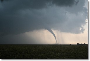
Weather Topic: What are Wall Clouds?
Home - Education - Cloud Types - Wall Clouds
 Next Topic: Altocumulus Clouds
A wall cloud forms underneath the base of a cumulonimbus cloud,
and can be a hotbed for deadly tornadoes.
Wall clouds are formed by air flowing into the cumulonimbus clouds, which can
result in the wall cloud descending from the base of the cumulonimbus cloud, or
rising fractus clouds which join to the base of the storm cloud as the wall cloud
takes shape.
Wall clouds can be very large, and in the Northern Hemisphere they generally
form at the southern edge of cumulonimbus clouds.
Next Topic: Altocumulus Clouds
Current conditions powered by WeatherAPI.com


