Weather Alert in Alaska
Winter Weather Advisory issued February 18 at 3:14PM AKST until February 19 at 9:00PM AKST by NWS Juneau AK
AREAS AFFECTED: Glacier Bay; Eastern Chichagof Island; Admiralty Island
DESCRIPTION: ...ACCUMULATING SNOW ACROSS THE PANHANDLE TO END THE WEEK... .A front moving across the gulf and developing low across the northern coast will bring snow showers to the panhandle beginning late Wednesday night. With stable cold dry continental air in place ahead of this system, precipitation is expected to remain snow throughout the event with high snow ratios. The initial frontal wave will push eastward into the panhandle with the northeast gulf coast seeing showers late tonight and highest snow accumulations expected along the outer coast with orographic enhancement. For most areas, snow is expected to be light and fluffy in nature due to cold temperatures both aloft and down to the surface. * WHAT...Snow expected. Total snow accumulations of 3 to 6 inches. * WHERE...Glacier Bay, Eastern Chichagof Island and Admiralty Island. * WHEN...From 3 AM to 9 PM AKST Thursday. * IMPACTS...Travel could be very difficult. * ADDITIONAL DETAILS...Snow showers will begin to impact communities along Icy Strait and Admiralty Island early Thursday. There is some uncertainty as to heavier snow showers developing further inland Thursday evening as the low tracks southward along the outer coast and a deformation band sets up.
INSTRUCTION: Slow down and use caution while traveling. People are urged to prepare their property before the onset of winter weather. For the latest road conditions, where available, call 5 1 1 or visit 511.alaska.gov.
Want more detail? Get the Complete 7 Day and Night Detailed Forecast!
Current U.S. National Radar--Current
The Current National Weather Radar is shown below with a UTC Time (subtract 5 hours from UTC to get Eastern Time).

National Weather Forecast--Current
The Current National Weather Forecast and National Weather Map are shown below.

National Weather Forecast for Tomorrow
Tomorrow National Weather Forecast and Tomorrow National Weather Map are show below.

North America Water Vapor (Moisture)
This map shows recent moisture content over North America. Bright and colored areas show high moisture (ie, clouds); brown indicates very little moisture present; black indicates no moisture.

Weather Topic: What is Condensation?
Home - Education - Precipitation - Condensation
 Next Topic: Contrails
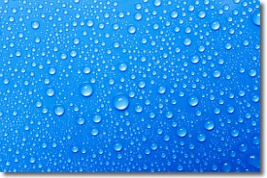
Condensation is the process which creates clouds, and therefore
it is a crucial process in the water cycle.
Condensation is the change of matter from a state of gas into a state of liquid,
and it happens because water molecules release heat into the atmosphere and
become organized into a more closely packed structure, what we might see as
water droplets.
Water is always present in the air around us as a vapor, but it's too small for
us to see. When water undergoes the process of condensation it becomes organized
into visible water droplets. You've probably seen condensation happen before on the
surface of a cold drink!
Next Topic: Contrails
Weather Topic: What are Cumulonimbus Clouds?
Home - Education - Cloud Types - Cumulonimbus Clouds
 Next Topic: Cumulus Clouds
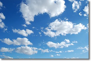
The final form taken by a growing cumulus cloud is the
cumulonimbus cloud, which is very tall and dense.
The tower of a cumulonimbus cloud can soar 23 km into the atmosphere, although
most commonly they stop growing at an altitude of 6 km.
Even small cumulonimbus clouds appear very large in comparison to other cloud types.
They can signal the approach of stormy weather, such as thunderstorms or blizzards.
Next Topic: Cumulus Clouds
Current conditions powered by WeatherAPI.com


