Weather Alert in Indiana
Flood Warning issued March 4 at 3:57AM EST until March 8 at 8:00AM EDT by NWS Indianapolis IN
AREAS AFFECTED: Bartholomew, IN; Jackson, IN
DESCRIPTION: ...The National Weather Service in Indianapolis IN has issued a Flood Warning for the following rivers in Indiana... Big Blue River at Shelbyville. Driftwood River near Edinburgh. Flatrock River near Columbus. East Fork White River at Columbus. White River at Spencer. Eel River at Bowling Green. ...Forecast flooding changed from Minor to Moderate severity and increased in duration for the following rivers in Indiana... East Fork White River at Seymour. .Between 2 and 4 inches of rain have fallen across central Indiana as of early Wednesday morning. Up to 2 inches have fallen in south-central Indiana. This has led creeks to rise above flood stage and rivers will follow in the coming days. Additional rain is in the forecast over the next several days. * WHAT...Minor flooding is forecast. * WHERE...East Fork White River at Columbus. * WHEN...From late tonight to Sunday morning. * IMPACTS...At 11.2 feet, State Road 11 in the Garden City area closed at this level during March 2008 flood. Every road leading to or crossing the East Fork White River in Bartholomew County except for State Road 46 was flooded during the bigger March 2008 flood. * ADDITIONAL DETAILS... - At 3:00 AM EST Wednesday the stage was 2.3 feet. - Forecast...The river is expected to rise above flood stage late tonight to a crest of 10.9 feet early Friday afternoon. It will then fall below flood stage Saturday evening. - Flood stage is 9.0 feet. - http://www.weather.gov/safety/flood
INSTRUCTION: Motorists should not attempt to drive around barricades or drive cars through flooded areas. Additional information is available at www.weather.gov/ind. The next statement should be issued this evening by around 700 PM EST.
Want more detail? Get the Complete 7 Day and Night Detailed Forecast!
Current U.S. National Radar--Current
The Current National Weather Radar is shown below with a UTC Time (subtract 5 hours from UTC to get Eastern Time).

National Weather Forecast--Current
The Current National Weather Forecast and National Weather Map are shown below.

National Weather Forecast for Tomorrow
Tomorrow National Weather Forecast and Tomorrow National Weather Map are show below.

North America Water Vapor (Moisture)
This map shows recent moisture content over North America. Bright and colored areas show high moisture (ie, clouds); brown indicates very little moisture present; black indicates no moisture.

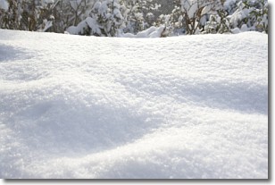
Weather Topic: What is Snow?
Home - Education - Precipitation - Snow
 Next Topic: Stratocumulus Clouds
Snow is precipitation taking the form of ice crystals. Each ice crystal, or snowflake,
has unique characteristics, but all of them grow in a hexagonal structure.
Snowfall can last for sustained periods of time and result in significant buildup
of snow on the ground.
On the earth's surface, snow starts out light and powdery, but as it begins to melt
it tends to become more granular, producing small bits of ice which have the consistency of
sand. After several cycles of melting and freezing, snow can become very dense
and ice-like, commonly known as snow pack.
Next Topic: Stratocumulus Clouds
Weather Topic: What are Stratus Clouds?
Home - Education - Cloud Types - Stratus Clouds
 Next Topic: Wall Clouds
Stratus clouds are similar to altostratus clouds, but form at a
lower altitude and are identified by their fog-like appearance, lacking the
distinguishing features of most clouds.
Stratus clouds are wider than most clouds, and their base has a smooth, uniform
look which is lighter in color than a nimbostratus cloud.
The presence of a stratus cloud indicates the possibility of minor precipitation,
such as drizzle, but heavier precipitation does not typically arrive in the form
of a stratus cloud.
Next Topic: Wall Clouds
Current conditions powered by WeatherAPI.com


