Weather Alert in Wyoming
Winter Storm Warning issued February 25 at 1:31AM MST until February 25 at 5:00PM MST by NWS Riverton WY
AREAS AFFECTED: Teton and Gros Ventre Mountains; Salt River and Wyoming Ranges
DESCRIPTION: * WHAT...Heavy snow. Additional snow accumulations of 6 to 12 inches, with isolated higher amounts up to 15 inches. West winds with frequent gusts of 40 to 50 mph. * WHERE...Teton and Gros Ventre Mountains and Salt River and Wyoming Ranges. * WHEN...Until 5 PM MST this afternoon. * IMPACTS...Travel could be very difficult. The hazardous conditions could impact the Wednesday morning commute, especially over Teton and Togwotee Passes. * ADDITIONAL DETAILS...Snowfall rates will generally be between 0.5 and 1 inches per hour.
INSTRUCTION: If you must travel, keep an extra flashlight, food, and water in your vehicle in case of an emergency. For graphical depictions of the snowfall forecast, including the official NWS forecast, high end amounts, and low end amounts, visit https://weather.gov/riw/winter . For winter road conditions from the Wyoming Department of Transportation, visit https://wyoroad.info .
Want more detail? Get the Complete 7 Day and Night Detailed Forecast!
Current U.S. National Radar--Current
The Current National Weather Radar is shown below with a UTC Time (subtract 5 hours from UTC to get Eastern Time).

National Weather Forecast--Current
The Current National Weather Forecast and National Weather Map are shown below.

National Weather Forecast for Tomorrow
Tomorrow National Weather Forecast and Tomorrow National Weather Map are show below.

North America Water Vapor (Moisture)
This map shows recent moisture content over North America. Bright and colored areas show high moisture (ie, clouds); brown indicates very little moisture present; black indicates no moisture.

Weather Topic: What is Drizzle?
Home - Education - Precipitation - Drizzle
 Next Topic: Evaporation
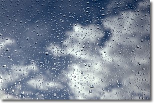
Drizzle is precipitation in the form of water droplets which are
smaller than raindrops.
Drizzle is characterized by fine, gently falling droplets and typically does not
impact human habitation in a negative way. The exception to this is freezing drizzle,
a condition where drizzle freezes immediately upon reaching earth's surface.
Freezing drizzle is still less dangerous than freezing rain, but can
potentially result in hazardous road conditions.
Next Topic: Evaporation
Weather Topic: What is Fog?
Home - Education - Cloud Types - Fog
 Next Topic: Fractus Clouds
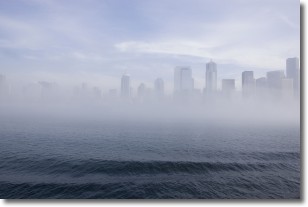
Fog is technically a type of stratus cloud, which lies along the
ground and obscures visibility.
It is usually created when humidity in the air condenses into tiny water droplets.
Because of this, some places are more prone to foggy weather, such as regions
close to a body of water.
Fog is similar to mist; both are the appearance of water droplets suspended in
the air, but fog is the term applied to the condition when visibility is less than 1 km.
Next Topic: Fractus Clouds
Current conditions powered by WeatherAPI.com


